Monday, May 25, 2009

Picks and Pans

Here it is folks, the ballots are in.  This is the moment you all have been waiting for.

Favorite Towns

  • Wanaka - Set on a beautiful mountain lake, Wanaka was a nice, laid-back place to relax for a few days. There were also a lot of cool activities, including a hip cinema and Puzzling World.
  • Te Anau - Also set on a beautiful mountain lake, Te Anau was even more laid-back than Wanaka.  A great place to relax.

Least Favorite Towns

  • Glenorchy - Sure, this town is the gateway to some great hikes, but its residents like to rip you off on everything from camping food, to "secure parking," to dingy hotel rooms.
  • Haast - To quote Jay, "This is a sh*t-town in the middle of nowhere isolated on the west coast. The only reason to be here is to get from the west coast to Wanaka."

Favorite Cities

  • Wellington - This was a really hip city with a good vibe where there was a lot to see and do and lots of good places to eat in between activities.
  • Nelson - Plenty of sun, beaches, great location close to national parks, and very clean...what more could you want?

Least Favorite Cities

  • Dunedin - Maybe it was just the crappy weather affecting my mood, but I found Dunedin pretty boring.
  • Auckland - Auckland is clean, modern, and metropolitan, but lacks character.

Favorite Hikes

  • Rees-Dart - The scenery on this hike was amazing and the weather made it even better.
  • Abel Tasman - Beautiful beaches and easy walking. This hike was peaceful and relaxing.
  • Tongariro Northern Circuit - The pictures really speak for themselves, this area was totally unique and awe-inspiring.
  • Routeburn - This is a classic tramp with fantastic and accessible scenery, beautiful huts, and a great taste of what southern New Zealand has to offer.

Least Favorite Hikes

  • South Coast Track - Mud, bush, and hills with very little scenery...for 7 hours a day. It wasn't worth the effort.

Favorite Tourist Attraction

  • Stuart Landsborough's Puzzling World - This place was sooo much fun! There was a giant maze and a room full of puzzles - a great way to spend a rainy day.
  • Speight's Brewery Tour - This was a very cool brewery that still uses nearly 100 year old equipment. The all-you-can-drink free samples at the end were also very well-recieved.

Favorite Large Hostel

  • YHA Rotorua Treks - This hostel was brand new, had comfortable beds, and great lounge and kitchen facilities.
  • Purple Cow Backpackers - This hostel also had comfortable beds and a great kitchen and lounge. It also had ping pong and a huge projection screen for movies.
  • YHA Franz Josef - This hostel had a huge kitchen, great beds, and a free barbeque the night we were there.

Least Favorite Large Hostel

  • On the Beach Backpackers - The kitchen had an ant problem, the building was old, and the beds were terrible.
  • YHA Auckland - This was a bit of a disapointment, considering its five star rating. The place was a bit dingy and run-down and I caught the cleaning lady almost throwing out our food (even though it was correctly labelled).

Favorite Small Hostel

  • Endless Summer - This was in a beautiful 1880s house where the owners have thought of everything. It even had a dishwasher.
  • Lauder Store - This was more of a bed and breakfast, but they had pretty close to hostel prices. They had recently converted a 100 year old mud brick store and extended it into a beautiful B&B.
  • Arthur's Pass YHA - Very cosy, great location, and a great kitchen and lounge.

Least Favorite Small Hostel

  • Glenorchy - Very dingy, dirty bathroom, and sketchy bedding.

Best Beaches

  • Abel Tasman National Park - These beaches are sheltered, stunning, and, best of all, not accessible by road.
  • Hot Water Beach - At this beach, you could dig a hole and it would fill with hot water to give you your own hot tube. Need we say more?

Best Mountain

  • Mt. Aspiring - Considering the helicoptor-like view that we got of it, this mountain was pretty awe-inspiring.
  • Mr. Ngauruhoe (aka Mt. Doom) - A classic concical volcanoe in the middle of a flat platau. It draws your attention from miles away.

Best Restaurants

  • Catch, Wellington - Very fresh sushi from a conveyor.
  • Fergburger, Queenstown - You cannot miss Fergburger when you go to Queenstown. Probably the largest and most delicious burger either of us will ever eat.
  • La Toscana, Te Anau - Great post-hike pizza.

Worst Restaurants

  • Curry place in Westport - The worst curry ever. It tasted like Cambell's soup.

Best Place for Fish and Chips

  • Christchurch - Three dollars for fish and chips.  That was a bargain and a half.
  • Nelson - Very fresh fish and great chips.

Favourite Cadbury Chocolate

  • Energy - This exclusive to New Zealand chocolate was darker than milk chocolate but not as dark as dark chocolate. We went through about 1 kg of it.
  • Tiramisu (dessert line) - Essentially chocolate with coffee cream filling. Once we opened a bar, it was gone really fast.

Best Place to Destroy the One Ring

  • The summit of Mt. Ngauruhoe 

Best Wildlife Encounter

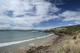
  • Yellow Eyed Penguin, Curio Bay - This little guy was sooo cute. He was hopping along the rocks on the shore.
  • Seal pup, Abel Tasman - This guy was playing in the surf near our campsite.

Worst Wildlife Encounter

  • Sandflies.  These are horrble. Their bites are so itchy that they wake you up in the night and last for days.
  • The sheep poop and dead rabbit along the trail up Mt. Roy.
  • Wekas - These flightless birds were very good at stealing our food and even made off with an oatmeal-covered spoon.

Cheers,

Erin and Jay

Monday, May 18, 2009

Back Home

Hi everyone,

In case you were worried, I just wanted to let you know that we made it back to Edmonton!

Cool things we did in Auckland:

-went to the zoo and saw kiwis, giraffes, hippos, monkeys, kangaroos....

-had some delicious food 

-saw the improv show Scratch that was part of the New Zealand Comedy festival. This was really cool because Scratch is from Edmonton and we have seen them perform man times in Edmonton

-went shopping for some luggage to transport our remaining possessions home

-went to the Auckland museum (we didn't leave nearly enough time for this, it was a really nice museum)

The flight home didn't seem as long or arduous as the flight to New Zealand (probably because we only had two flights instead of four). Now we are back in Edmonton and we are pretty jet-lagged and in the process of unpacking, opening our mail, etc. It is really nice to be home!

Later this week we will post a list of our picks and pans, so stay tuned!

Tuesday, May 12, 2009

Far North

Hey everyone!

I am writing from Auckland, where we will spend the last few days of our trip.

After hanging out in the Bay of Islands, we drove farther north to Ahipara, a tiny town on the coast. There was a really nice hostel there, so we decided to stay for four days. Unfortunately, on the first night, our car was broken into and a lot of our stuff was stolen, including Jay's camera gear and a lot of our hiking equipment. Luckily, all of our photos had been downloaded from the camera to the computer so we didn't lose any of those. Our travel insurance (and possibly our renter's insurance) will cover some of the stolen items, so we are really glad we got insurance on our baggage. I definitely would recommend it to anyone who is travelling!

We spent a few days hanging out, going surfing and swimming, and making friends at the hostel. The hostel itself was an old house built in the 1880s and had beautiful high ceilings and wood floors. The hostel was also quite small, so we got to know a few people and had a good time hanging out. It was a pretty difficult place to leave this morning!

Now we are in Auckland, New Zealand's largest city. We have returned the rental car and we plan on checking out the museum, zoo, and park. It is hard to believe that we only have 3 days left here!

We will probably post again with some stories from Auckland and a wrap-up post, including our picks and pans.

Erin

Tongariro Photos

Hey everybody,

Here are the photos from our only North Island tramp, Tongariro Northern Circuit. It was beautiful and amazing and you should really check them out, I think the photos turned out quite nice.

Link to the Gallery

Some samples:

From Tongariro Northern Circuit

Mt Taranaki on the horizon at sunset.


From Tongariro Northern Circuit

At the top of Mt Doom.


From Tongariro Northern Circuit

Mt Ruapehu - weather transition


Well, it's been fun photographing this trip. There were certainly heaps of cool things to see. Unfortunately these are my last photos from the trip, as my camera and camera gear were stolen when our car got broken into on Friday night in Ahipara in the Far North. Sucks!

Thursday, May 7, 2009

Photos from Rotorua, Coromandel, and Raglan

Hey folks,

Got some more photos for you... 3 Albums!

Rotorua... Maori cultural performance and some geothermal oddities!
From Rotorua
The chief!

From Rotorua
We did not swim in it.

Cathedral Cove, near Whitianga on the Coromandel Peninsula.
From Cathedral Cove
A sweet rock formation on the beach.


Raglan... and learning to surf.
From Raglan
Choo choo :) Our very own caboose!

Wednesday, May 6, 2009

Tongariro Northern Circuit

Good morning/afternoon/evening everyone!

We just completed our final tramp in NZ and I know you are all dying to hear about it....
The trip we completed was the Tongariro Northern Circuit. It was a four day trip in Tongariro National Park, a very volcanic area of the country.

Day One: Was pretty boring. We only hiked for three hours and then sat around in a hut all day. We had really good views of a Mt. Ngauruhoe, a huge volcanoe that was used as Mt. Doom in Lord of the Rings.

Day Two: Included the Tongariro Crossing, NZ's most famous day walk. Even though we left the hut at 8 am, we were surrounded by day walkers for the first half of the hike. It was pretty funny to see how unprepared they were for the weather and how out of shape they were walking up the first stretch of hill. Pretty early in the day we did a side trip up Mt. Ngauruhoe (Mt. Doom). It was a pretty tough climb and the weather at the top was very cloudy and very cold. Jay's leg hair was frozen into little strands of ice. There was no visibility at the top, but we could see the edge of a giant crater. Despite the weather, I think we are both pretty happy to say that we have climbed Mt. Doom. Day Two also included walking across two giant craters and some great views of a red crater and some emerald coloured lakes.

Day Three: The very cold weather continued on Day Three. There was a pretty severe wind chill for most of the day and our faces are definitely burned from it. However, the day included walking among rocks from a lava flow. It was like walking on Mars...very very cool.
Day Four: Was also very cold with misty rain for most of the day. On the last day of the hike we usually are ready for a shower and some real food, so we just walk as fast we can.
After the hike, we drove to Rotorua and went to the Polynesian Spa for a soak in the famous healing waters of the Priest Spa. It was a pretty relaxing end to the hike.

We spent all of today driving from Rotorua to Paihia in the Bay of Islands. The drive was supposed to take 6.5 hours but ended up taking almost 8 because a semi rolled on the highway and we got sent on a crazy detour.

We are planning on spending the next 5 or 6 days relaxing on the beaches in the north and then we will head to Auckland to catch our flight back home.

Take care,
Erin

Thursday, April 30, 2009

Hot Beach and Surfing

Hello hello!


When I last updated you, we were in Rotorua and the forecast was still really unpleasant for Tongariro, the area where we want to do our next hike. We decided to head north to the Coromandel Peninsula and see the sights while waiting on the weather.

The drive to Coromandel was really pretty. The hills pretty much all looked like Hobbit hills. There were also some really cool sights to see in Coromandel. We did a short walk to Cathedral Cove, which was a really cool beach that had a huge cave/tunnel. It was very pretty. After Cathedral Cove, we went to Hot Water Beach. That's right, Hot Water Beach. Hot Water Beach is a beach that has a natural hot spring under it. Around low tide you can dig a shallow hole in the beach and have your very own hot tub. The water is around 60 degrees Celcius, so we ended up having to devise a system of canals in order to not burn ourselves, but it was really worth the effort. We had the only hot pool with continuous inflow and outflow. (Trust a plumber's daughter). Hot Water Beach was AWESOME.

The next day we drove from the east coast to Raglan on the west coast. Raglan is world-famous for its surfing so we signed up for a lesson and gave it a try today. Surfing was also AWESOME. We had a good instructor and we both managed to stand up pretty easily. It was really fun and I was really impressed with how quickly we learned. Here is a picture of Jay:


Another cool thing about Raglan is that our hostel room is actually an old rail caboose. The hostel has about 15 cabooses and train cards in the yard. It is pretty cool.

The weather is finally getting better in Tongariro so we are heading back south tomorrow and we will hopefully be starting the Tongariro Northern Circuit on Saturday. We will be happy to be back on the trail.

Photos from Wellington, Napier, Taupo

Sorry these took a while to get posted. The Wellington ones are as old as 12 days, wow. Well here are the links to the 3 new galleries, and a juicy sample from each one. Wow! Erin is probably going to write a new post later today, detailing our latest exploits. No spoilers!

Wellington Gallery
From Wellington


Napier Gallery
From Napier


Taupo
From Taupo

Sunday, April 26, 2009

Rain, rain, go away...

Since our last post, it has been raining every day and isn't going to get better anytime soon :(. Instead of starting our hike, we have been travelling in the Central Plateau region.

From Napier, we went to Taupo. Taupo is situated on Lake Taupo, NZ's largest lake. In Taupo we visited a dam and watched the river level as they opened and closed the floodgates of a dam. This was a bit more interesting than it sounds because the river was quite narrow after the dam, so the level rose really fast and created some pretty intense rapids.

After the dam, we went on a walk to the Huka Falls. The best part of the walk wasn't the falls (which were pretty nice), but the hot water stream at the start of the track. That's right...hot water stream! There was a pretty wide stream that was about knee deep and about 45 degrees Celsius right off of the track where we had a rest and soaked our feet...pretty awesome.

Yesterday we drove from Taupo to Rotorua. Rotorua is a touristy town in the centre of the thermal region. It is crazy driving through this region because there is steam rising from the sides of the road and a pretty strong smell of sulfur. In the evening we went to a Maori cultural performance. The evening started with an entrance of Maori warriors on a war canoe, followed by a traditional greeting and performance. After the performance, we had hangi, a feast cooked in a traditional method of digging a hole, filling it with hot rocks, burying the food with the hot stones, and letting it cook for several hours. The whole evening was really cool and I'm glad that we splurged on it.

This morning we visited a thermal area. We saw a geyser erupt 10-20 m in the air and then we toured the grounds. There were huge craters, boiling mud pools, and coloured lakes...it was really awesome.

Right now we are hanging out in the hostel. We don't really have any firm plans for the next few days because except that we will be keeping our eyes on the forecast for when we might be able to start our next hike.

Thursday, April 23, 2009

Picton -> Wellington -> Napier

Hiii. We're in Napier right now, which is a little city on the south east coast of the North Island with a lot of character and a lot of wineries and vineyards in the area. More on that later.

Wellington was quite the nice city, but very windy. It's very pretty, and has maybe five times the urban hipness of Edmonton despite being less than half the size. Its hip city centre is totally cool! The YHA was huge and very nice. In Wellington we checked out the parliament (including the “Beehive”) and when on a tour there, and we went to Te Papa, which is Wellington's big ol' national museum. We were going to go to the city art gallery but it was CLOSED for renovations. Cafes and restaurants were visited and we had lots of good food, including splurging on some good sushi for dinner, which was overdue, I'm sure. Well, Wellington was nice but we have other places to see, so we headed off to...

Napier! Napier's really cool. It's been around since the mid 1800's I think, but an earthquake leveled the place in the early 1930's. The Art Deco style of architecture was very popular in America and Europe at the time, so all the buildings were rebuilt in that style. As a result I think it's pretty much the only place in the world with such a high concentration and amount of Art Deco architecture in the world. And I love it! It's so cool. It's retro but fresh at the same time. Like Coca Cola Classic, no? Other than than Napier is in the Hawke's bay area which is one of the oldest and more prestigious wine making areas in the country. Yesterday we rented bikes with the intent of biking to some nearby wineries to check them out and taste some samples, but the area was surprisingly built up in suburbia, with plenty of traffic. Well, we did make it to two wineries, but we'd had enough. Erin says it wasn't really what she expected. No little country roads, the wineries surrounded by suburban development.

I have no idea where we're going today. We're visiting the Napier museum and going to the NZ National Aquarium which is in town here, and then we're off to … I don't know. Either Gisborne, which is further east and north along the coast (it is the first city in the world to see the light of the new day... really ahead of the times), or into the interior, where there is our next tramp, volcanoes and geothermal activity, and a massive lake. Depends on the weather, Erin tells me.

Saturday, April 18, 2009

Nelson Lakes photos are here

I make special for you. Enjoy.

From Nelson Lakes National Park
Sunset at St Arnaud.


From Nelson Lakes National Park
Angelus Hut and Lake Angelus.


From Nelson Lakes National Park
Milky Way over Mt Angelus.


From Nelson Lakes National Park
Lake Rotoroa in the morning.


Link to the full gallery ! !

Thursday, April 16, 2009

And now we are in Picton

Hi everyone!

We just finished up a four-day excursion in Nelson Lakes National Park and it was a trip of extremes- it involved my favorite and least favorite days of hiking, as well as some extreme weather, and extremely crowded (and then uncrowded) huts.

The first day was probably my favourite day of hiking that we have done in New Zealand. The sky was pretty clear for 9 km of ridge walking, which was really cool. We passed along three different basins, all speckled with snow. The moutains were definitely the most epic-looking ones that we have come across in New Zealand. The hut we stayed at, Angelus Hut, was in an amazing locataion. It was in a basin right on a lake surrounded by high peaks.

On the second day, we had the worst weather we have had for hiking. The visibility was probably less than 5m at times and there was rain and strong winds. Luckily, we had planned to stay at Angelus hut for a second night and just do a side trip that day, so we cancelled the side trip and hung out in the hut all day. We we also in a very crowded hut that night - there were 26 beds and about 36 people because it was Easter weekend and there are two weeks of school holidays right now. I was ready to get the heck out of there the next morning.

On day three, we woke up to amazingly clear skies and hardly any wind. We did another ridge walk followed by a very very steep, muddy, and forested downhill that had me swearing by the end. At the end of the hike, we were greeted by the emptiest hut we have been to - 36 beds and only six people, so that was a real treat.

Day four was probably my least favorite day of hiking we have done on the trip. It was 7.5 hours of stepping over roots, around trees, and going up and down little valleys, through the forest the entire time. The end could not have come soon enough.

This was our last hiking trip on the south island and we are heading to the north island the day after tomorrow.

Cheers,

Erin

Friday, April 10, 2009

Abel Tasman Track photos

Here they are, enjoy.

>>>Link to the Gallery! <<<


From Abel Tasman Coast Track

Remains of Tonga Quarry


From Abel Tasman Coast Track

The beach at Mutton Cove


From Abel Tasman Coast Track

yay beaches!

Abel Tasman Coast Track

Greetings from sunny Nelson!

Yesterday we finished up the Abel Tasman Coast Track. The track was very beautiful. It was five days of meandering through forest and across beautiful beaches.

The Track:

The track was pretty much a walk in the park compared to the hikes we have done. The Department of Conservation doesn't even recommend that you wear boots for the walk, just running shoes. I also read a magazine article about a man pushing a stroller with his nine month old in it, and I believe that it could be done pretty easily. The track alternated between walking through forest and along very beautiful (and nearly deserted) beaches. We were able to take lots of time to lie in the sun and swim in the ocean during the day. It was a pretty relaxing time.

The Weather:

We had pretty good weather, but we did end up drenched in the pouring rain one day. It was getting pretty depressing, but then we stopped at our campsite and the sun came out and everything dried off and we were able to go swimming. It was also pretty cold on the last day of the hike, and there was snow on the tops of the nearby hills/mountains, but we survived.

The Wildlife:

There were some really cute seals playing in the surf by our last campsite and it was pretty cool to watch them play.
We also had our first (live) possum sighting. Previously, we have only seen dead possums on the road. The Department of Conservation recommends that you keep your food in your tent so that the possums cannot get into it. We don't really have room in our tent for our food, so we kept it in a airtight bag in the vestibule. During the night, something (possum or mouse or rat) chewed through two bags to get to the food, but didn't manage to steal anything.
Also, the sandflies continue to gnaw away at us. They were not as horrible as in Fiordland or the West Coast, but maybe that is because we have moved up from Deep Woods Off (25% DEET) to a lotion containing 40% DEET. We are both covered in bites still though. I even have one inside of my ear.

The Toe Report:

Jay is now minus two big toenails. Hopefully he does not post any pictures, because they look worse than before, but apparently they feel a lot better, and that is what counts, right?

Our next move:

We are spending today (Good Friday) in Nelson. Everything is closed so we are just going to be hanging out in the hostel. Tomorrow or Sunday we will head down to Nelson Lakes National Park to do our last hike on the South Island. I hear that there are beautiful lakes and snow capped mountains there, so it should be pretty beautiful.


That is all for now. Stay tuned for Jay's pictures of the awesome beaches. And have a hoppy Easter everyone!

Saturday, April 4, 2009

Happy Birthday Siblings!

Happy birthday to our siblings who are turning 21!

Have fun!

Love, 

Erin and Jay

Wednesday, April 1, 2009

Avalanche Peak photos

Good evening, folks!

Whee! We've been in Arthur's Pass in the middle of the Southern Alps for a few days now, waiting for the weather to improve so we could climb up a popular day hike to Avalanche Peak. Well today was the day and yes sir it was a great hike. Over one vertical kilometre was climbed, and over one vertical kilometre was descended. The climb in many places was semi-scrambling, which I appreciated. It was quite steep, no bullshit... we climbed it in 3 hours but we really took our time. I think I could have done it in 2. Yeah. Well despite today's forecast, it was quite cloudy at the top, and we waited at the summit for over an hour for the clouds to go away, but they wouldn't! We were getting cold so we started descending, and not long after things really started clearing up! Oh well, we were still above the treeline at that time and got nice views. Did I mention the keas? NO? WELL.

These birds are hilarious and awesome. They are green with bright red armpits, the only mountain parrot in the world, exclusive to NZ, very intelligent, social, and curious, and in no way shy around people. And they are SO BAD. If you're not careful/smarter than a kea you will defintely get your things that you left lying on the ground either chewed up, stolen, or both. At one spot above the treeline I took off my pack and was changing camera lens and while I did this I got surrounded by 5 very curious kea, who all wanted to know what was in my bag or what my boots tasted like. Fighting off 5 kea is pretty challenging, but don't worry, they don't fly at you or anything. Once they're where they want to be they walk and hop around.

Link to the AVALANCHE PEAK Gallery

A sample:
From Arthur's Pass, Avalanche Peak
Erin faces a kea...


Well, that's it for now. Tomorrow we drive to the northern part of the west coast, where we will hike and camp on the end part of the Heaphy track for one night. Then it's eastward bound where we will before long do the Abel Tasman Coastal Track!

Fox Glacier Pictures

Here we go! I personally hand-picked the best photos I had from our glacier trek and have uploaded and now am presenting them to YOU, yes YOU for an exclusive engagement with GLACIER PHOTO 2009...

BOOK NOW!! (Gallery)

See what's inside...


From Fox Glacier

Jay On Ice


From Fox Glacier

Glacier no obstacle for Erin!


From Fox Glacier

Yes, this was for real

Earth Hour

At the Franz Josef YHA, they had an Earth Hour event: free BBQ (although it was vegetarian... oxymoron if you ask me!) and candle-light dinner for it. Pretty cool. Here's what it looked like.


Saturday, March 28, 2009

Rees Dart Tracks and Cascade Saddle

These photos are much more pleasant than that toe one, I promise! (sorry)

Link to the Gallery

Some samples...

From Rees Dart Track
Rees valley


From Rees Dart Track
Dart Glacier


From Rees Dart Track
A view from Cascade Saddle. Mount Aspiring is the snowy peak on the left.

"My toes felt just like two balloons..."

My entire big toenails are going to fall off eventually, and they hurt when walking and standing a bit... but the worst is over, because both my toes looked like this by the fourth day on the Rees Dart track, and even bigger on the fifth (last day):


Giant blisters formed under my nails, lifting them up, and stretching the skin around them like big balloons. Fortunately they weren't bloody, and the nails stayed attached. Walking in my boots was manageable (thankfully), but my sandals just couldn't fit my grossly enlarged toes.

What happened?? The first day of the track had several stream fords resulting in sopping wet feet/socks/boots, and I was wearing 2 layers of socks for comfort. Things expanded, there was less room for poor little toes, and the terrain was pretty technical in places. The toenails were already tender at the end of the first day. Second day was dry but I still had 2 layers of socks on (didn't know what I was getting myself into) and the terrain was much more technical with plenty of downhill. End of 3rd day, there was some swelling under the nails, enough to make walking around painful (especially in my sandals which cover the big toe). After 4th day they ballooned (see picture).

It's much better now though. The day after we got off the hike (yesterday), I went to the medical centre at Queenstown to get it looked at. The doctor offered to drain it – purely symptomatic – I said yes please! It was a very technical procedure: she heated up the end of a paper clip over a flame until red hot, then put it through the middle of the nail. Squirt! Ahh, much better. The student nurse then did the other one. Easy enough... now I know how it's done. I could do it again myself if I had to! Things are still kind of sore of course, but I'm not hobbling around anymore, and I should be good for tomorrow's day of hiking up Fox Glacier on NZ's West Coast (guided, of course), and hopefully good for the next tramp.


UPDATE: since writing this post things aren't as great as I thought. some skin broke around the front of the toe, so it's partially open now. boooo. hopefully the toenail stays on during some upcoming hiking, but... I'm having my doubts

Rees Dart Tramp

Once again, it has been a week without us posting. I would like to take this opportunity to apologize to everyone who is so enthralled with our adventures that they are checking every day, but end up disappointed 6 days a week. Although the back country huts in New Zealand have running water, they unfortunately do not have wireless.

The Rees-Dart hike was awesome in many ways. We had sunny weather for most of the hike and there was no rain. The company in the huts was great and we met lots of cool people from pretty much all over the world. The scenery was also incredible.

The hike started with a hike up the Rees valley. There were great views of the surrounding peaks for much of the first day. On the second day, we climbed over the Rees saddle into the Dart valley. The view from the saddle was awesome and we were able to climb a bit higher to get a 360 degree panorama of the area. On the third day we did a side trip to the Cascade Saddle and got probably the best view we have ever had. It was a pretty difficult climb and we were scrambling in places, but it was definitely worth the effort. Behind us was the massive Dart Glacier and in front of us was the massive, snowy Mt. Aspiring, the mountain that the national park we were hiking in is named after. The other side of the saddle dropped 600 feet into a beautiful valley and it was pretty crazy to sit on the edge of the cliff and look out on the valley below. The pictures from the saddle look like they are taken from a helicopter. It was a pretty hard to walk down from the saddle, and not just because the trail was so steep. The last two days were spent walking out through the Dart valley along the beautiful Dart river. I think that the pictures speak a lot louder than words for this hike.

I would just like to mention a few other things about this hike:

1. Bear Army: For those people who do not know what Bear Army is, it is basically an organization of people who like to hike slow, take in the scenery, and enjoy eating honey and berries (and chocolate). We met the couple who actually started Bear Army on this trip. Seriously. They were waaayyy later than everyone else getting to a hut one night because they stopped to take a nap in the sun. And they admitted that they have eaten a 250g chocolate bar in a day. They were pretty awesome.

2.Quinoa: (pronounced keen-wa): It is a grain from South America that is really good. It cooks like rice but has more flavor. It is also a contains all of the essential amino acids, unlike rice. We ate it every day on this trip and enjoyed it. It gets our stamp of approval.

3.Superfine merino: I bought a new shirt made of superfine merino wool, and it is awesome. It is as soft as cotton, but wicks away sweat. It is also not too hot or itchy like wool can be. It also did not stink after five days of sweating (And I mean really sweating. One day I drank 3L of water sweating.). Also, I think that it is pretty fashionable (it is the green shirt in the pictures). We actually went back to the store to buy more superfine merino garments after the hike.
After the hike, we had a Fergburger (a very large and delicious burger in Queenstown), a beer, and ice cream.

We are now in Franz Josef on the West Coast. We have taken it pretty easy for two days and tomorrow we are shelling out some cash to do a glacier walk. The glaciers are pretty unique here because the toes end in rainforest and we are only a few kilometers from the coast.

Well, that is about it for my update. I hope you enjoy Jay's pictures from the hike and the saga of his toes.

Friday, March 20, 2009

More photos

Got some more photos uploaded.

1. Dunedin photo gallery
From Dunedin


2. Otago Central Rail Trail photo gallery
From Otago Central Rail Trail


3. Wanaka photo gallery
From Wanaka

Rail Trail and Wanaka

Hey hey hey,

Sorry it has been so long since our last post. We have been too busy/lazy (there is such a fine line between busy and lazy and we walk it every day).

Anyways, since we last spoke we have done some pretty cool things. I will start from the beginning and work my way to the present.

About a week ago, we started a four day bike trip on the Otago Central Rail Trail. The trail is a former rail line that was taken out when it became legal to transport produce and wool by road. (Previously, the NZ government banned transport of produce by truck more than 75 km in order to protect the railway). The trail has been open for nine years and is really popular, especially with Kiwis from the north island.

The bike trip was great! The advantage to biking on a rail trail rather than on a road are that the rail trail never has more than a 1/50 slope, so it is never steep. Also, there is no traffic buzzing by all day. Besides the enjoyable biking, the scenery was amazing. It varied between lush farmland to rocky hillsides with mountains in the background. The photos really do not do it justice. We also had fantastic weather, it was 25 degrees all four days with no clouds and no wind.
Besides the great trail and scenery, the little towns that we passed through and stayed in were awesome. The popularity of the rail trail has revived a lot of the small towns in the area and a lot of residents have opened up bed and breakfasts along the trail. On the third night, we stayed in a store building that was built in the late 19th century from mud bricks. It was converted to a bed and breakfast last winter and the owners were really careful to maintain the bricks and the store front. The renovation turned out really well and it was a beautiful place to stay.

The hospitality that we experienced along the trail was also amazing. Everyone was very friendly and helpful and we had a lot of nice conversations with a lot of the locals and people visiting from the north island. We were also impressed with the meals that we had along the trail. We definitely did not expect the high quality dining that we got when we walked into the small town taverns.

Despite the sore legs and butts, the rail trail was definitely an awesome experience.

After the rail trail, we headed west to Wanaka, a small town north west of Queenstown. Wanaka is another town set on a picturesque lake surrounded by mountains. On our first day here, we went to Stuart Landsborough's Puzzling World, an attraction just outside of town. Puzzling World is probably one of the coolest places I have been to (because I am a huge nerd). They have some really cool exhibits, including a room with holograms on display, a room with famous people's faces that follow you as you walk around the room, rooms that play with perspective, and a giant, two story, modern maze that takes about an hour to complete. The also have a cafe where you can sit and play with an assortment of puzzles. Very cool!

Yesterday, we climbed Mt. Roy, a mountain just outside of Wanaka. It was about a three hour climb and a two hour descent. We had good weather and had great views of the surrounding area from the top of the mountain.

Today we are both a little sore and we are just taking it easy. We are going to see a movie later on at Paradiso Cinema, a cinema in town that we have heard a lot about. Each movie starts with an introduction from the owner and there is a cafe inside the theatre where you can get meals at intermission – it is supposed to be very cool.

In a day or two (when we feel recovered enough) we are going to head back down to the Queenstown area to start another tramp in the Rees and Dart valleys. The tramp is pretty highly recommended, especially by locals, so we are looking forward to that.

We hope that you all are well and not too cold (I hear that the weather is warming up),

Erin

Friday, March 13, 2009

Invercargill -> Dunedin

Hello everybody,

Greetings from Dunedin!

It has been a little while since we have posted because the Internet in the hostel was not working, so I guess I have a lot of catching up to do.

The first day of our Catlins tour was really beautiful. We headed south from Invercargill to Bluff and did a short walk to see a ship graveyard (where they parked ships to rot in the 1800s). After lunch in Bluff, we headed east along the coast. There were great views of the coast and the farmland along the way including this beautiful beach at Curio Bay:


Also at Curio Bay, we ran into this guy (or girl):


This is the rare yellow-eyed penguin. There are only 750 pairs in New Zealand. He was really cute hopping along the rocks.

After Curio Bay, we spent the night camping at a Department of Conservation campsite along the coast. The campsite was really beautiful because we had great views of the ocean and cliffs. Here is a glamour shot of our car at the beach during the moon rise:


The next morning we planned to do more sight-seeing along the coast, but the weather was horrendous. So we pulled into a backpackers (what the Kiwis call a hostel) in Owaka. It was the coolest hostel I have ever been to. Its décor definitely made it seem more like a bed and breakfast. We were staying in the “Bee Room” of a little three bedroom cottage. The room was decorated with little bees all over the wall and was very cute and homey. We spend the day hiding from the weather at the backpackers there.

We headed to Dunedin the next day. We have spent the last three days seeing the sights here, including a tour of a Cadbury Chocolate Factory and Speights Brewery. Both tours included lots of free samples!

Tomorrow we are starting a four-day bike trip of the Otago Rail Trail. It is a 150km bike trail that was created on a former railway, so it stops in several towns along the way. The weather forecast looks good, so we are both really excited.

Until next time,

Erin

Monday, March 9, 2009

Greetings from Invercargill

Hello folks! We're in Invercargill right now, stopping for a break at New Zealand's southernmost city between doing a one-night hiking trip on the South Coast Track and taking a leisurely drive along the Catlins Coast eastwards to Dunedin.

Our hike on the south coast track was a grueling state of affairs: 7 hours of hiking each way, with just maybe one hour of total beach walking each way, the rest of it was plodding along tiringly through the forest without a view and a good amount of mud. Glad I had my gaiters. The beach walking was nice though, and the destination, Port Craig Hut, is actually the old school house of the old, short-lived Port Craig, a failed lumber settlement, so that was cool I guess. But doing that hike before trying to do the 10-day Northwest Circuit on Stewart Island was a mistake! We need more recovery time now.

But for various reasons we've decided we don't really want to do the NW Circuit anymore. Too long, too hard, and not that many actual views of the ocean, despite walking the outside of the island the whole time. I do not need more viewless forest walking! And not doing this tramp frees up a lot more time on our trip. And not doing the 10-day circuit has basically eliminated our reason for going to Stewart Island entirely... the cost of transport isn't worth the day trip out there...

So we're going to take our time driving along the southeast coast, camping at a couple spots along the way until we get to Dunedin. In Dunedin, we've got the Speight's Brewery tour and Cadbury chocolate factory tour. Around Dunedin there's a penguin colony we'll try to see, too. Erin's keen on doing this multi-day bike tour out of Dunedin along the Otago Rail way. We'll see!

What about Invercargill? It's alright. :) If you check our Invercargill photo album, you'll see a few things we saw here. We went to the Museum and Art Gallery, and then wandered the adjecent Queen's Park, which contained some botanic gardens, rose gardens, a bird aviary. The museum has a section devoted to Burt Munro, the old kiwi bloke featured in the movie The World's Fastest Indian (he was from around here). So cool!

Before setting off towards Dunedin tomorrow, we're gonna stop in at Bluff, just south of Invercargill, which is a maritimey little town. Should be cool. See you folks again in Dunedin.


South Coast Track Photo Album

Invercargill Photo Album

Thursday, March 5, 2009

Milford Track Photos

And here some pictures from the Milford Track.

Link to the gallery.


A patch of glow worms found near our first hut.
From Milford Track

Routeburn Track Photos

Here are some pictures from the Routeburn Track. Ass you can see the clouds finally started to break up for our first time in NZ.

Link to the gallery.


Some highlights:

Driving halfway between Queenstown and Glenorchy, along Lake Wakatipu.
From Routeburn Track


A typical stream crossing
From Routeburn Track


Part of a long traversing of a slope on the Fiordland side of the hike.
From Routeburn Track

Wednesday, March 4, 2009

Routeburn/Milford

Hello to everyone who is still checking this blog after a week of no activity or pictures.

We finished the Milford Track yesterday and now we are relaxing and resting our legs in Te Anau for a few days before heading south. Te Anau is a really pretty town. Like Queenstown, it is surrounded by mountains and is next to a huge lake, but is much more laid back than Queenstown. The weather is beautiful, so it is going to be a nice place to spend a few days.

Now I will back-track and talk about the hikes we just did. I'm sure that Jay's photos will be much more interesting than my description, so I will try and keep the description brief.

Both hikes (the Routeburn Track and the Milford Track) are classified as Great Walks by New Zealand Department of Conservation. This means that the hike is relatively easy and that the huts that you stay in on the walks are really nice. Most hikes in New Zealand have huts along the track that you can sleep and cook in, but these ones have running (cold) water, flush toilets, and gas stoves all provided. Great Walks also have to be booked in advance because they are quite popular and bunk space is limited.

The Routeburn Track is a 3-day, 32km walk. We had great weather for the entire track and we did not have a drop of rain until we finished the walk. I had a pretty bad cold for most of the walk, so it made it pretty challenging. On the first day, we walked along the Route Burn valley and then up to the Routeburn Falls hut. The hut gave an amazing view of the entire valley and the surrounding mountains and was situated right beside a waterfall. It was a very cool place to spend a night.
The majority of the second day was spent above the tree line. We walked up to a mountain pass through a spectacular alpine meadow and then did a side trip to get a better view of the surrounding valleys. Unfortunately, it clouded over before we made it to the top, so we didn't get much of a view. We then walked along a ridge for about 3 hours before descending to our second hut next to the beautiful Mackenzie Lake.
On the third day we climbed back up above the tree line and got amazing views all the way to the Tasman Sea. We then descended to the trailhead and caught a bus back to Queenstown. Just as we reached the trailhead, it began to pour rain, so we were pretty lucky to have such good weather for the track.

The next day we headed to sunny Te Anau to get ready for the Milford Track. My cold was pretty much gone by then, so we were feeling pretty energetic about the next hike.

The Milford track is very famous in New Zealand and very hard to get a place on. Only 40 independent hikers and 50 guided hikers can start the hike every day, so spots on the hike are very sought after.
To get to the hike itself, we had to take a one hour boat ride across Lake Te Anau, which was very pretty. The first day of the hike was very easy and only took about one hour, so we had a lot of time to hang out in the afternoon and evening. During that time, I decided to go for a swim in the Clinton river, which is the clearest and most beautiful river I have ever seen. Unfortunately, the banks are infested with sand flies, which leave very (VERY) itchy bites. So, I had a very refreshing swim but I am now paying for because I am covered in bites. On the first evening of the hike, it started to rain and it didn't stop, which made for a very wet second day. Fortunately for us, the Milford Track is supposedly the most beautiful when it is raining, and I can understand why.
On the second day, we walked through a valley with hundreds of waterfalls on either side. The track alternated between going through lush rain forest and clearings where there were views of the waterfalls along the sides of the cliffs. It was an amazing day.
On the third day, it was still raining quite hard, and, unfortunately, this was the day that we did not want rain. We did a two hour climb to the top of Mackinnon Pass and saw absolutely nothing. It was completely miserable at the top of the pass; it was pouring rain and there was a very strong wind. The hike down the mountain and through the forest was still very beautiful, but we were both pretty disappointed about not getting a view from the pass. On the third day, we also did a side trip to NZ's tallest waterfalls(525 m), the Sutherland Falls.
The third day of the hike was pretty exhausting, it was over very easy terrain, but we had to do 18km and had to be at our boat by 2:00. There were beautiful views, including two more amazing waterfalls, along the way and Milford Sound, where the hike ended, was breathtaking.

So there you have it. A little play-by-play of our last week. I'm sure the pictures are what you are all after, anyways. Those will probably be up tomorrow if you want to check back.

Erin

Friday, February 27, 2009

Quickie

Hi everyone,

Just a quick update:

We finished the Routeburn track yesterday. We had great weather (no rain at all!) and the track was amazing.

Tomorrow we are starting the Milford track. The Milford track is world-famous and we had to book in in October to get a spot (only 50 people can start per day). A lot of people that we met on the Routeburn were pretty jealous that we got a spot on the Milford. So, needless to say, we are pretty excited.

We were pretty busy today with driving from Queenstown to Te Anau (where the Milford starts), unpacking, doing laundry, and repacking for the next tramp (and spending a little time enjoying the sunny weather).

The Milford takes 4 days, so you will get all of your photos after that.

Buh-bye,

Erin

Monday, February 23, 2009

Photos: Lake Tekapo to Queenstown

Driving from Christchurch to Mt Cook, we stopped at Lake Tekapo for lunch.

Here are pictures.

Between Mt Cook and Queenstown:


Today we did a day hike near Queenstown. A few pics from that excursion.

And this is our hostel room:
From Jay and Erin's Excellent Adventure!

Sunday, February 22, 2009

Hi from Queenstown!

Today we made the drive from Mount Cook to Queenstown. Today it's STILL the same lousy weather we've been getting since Friday. It was rainy and ugly this morning so we didn't do the hike at Mt Cook—there'd be nothing to see anyhow.

The drive was nice and scenic though. And never boring, what with all its winding about.

Erin thinks Queenstown is like Banff—on steroids. I can agree to that.

The hostel here is nice. It's on the lake, and our room – the best room in the building, we think – has a balcony that overlooks the lake. Sweet as...

Tomorrow's a day off (might do a day hike with some good elevation and a view), and the day after that we start our first tramp: Routeburn Track. Hoorah!

Expect photos from our journey to Queenstown via Mt Cook perhaps tomorrow?

Laters

Neato.

I added this gadget thing that puts my web albums on the side of the page here ---->

And it auto-slideshows. NEEEAT.

Christchurch pics

Hey folks

Sorry, I meant to upload these last night but the intrnet conked out. Here ya go.

CHRISTCHURCH GALLERY

A sample of what's inside!


Captain Cook!
From Christchurch


Robert Falcon Scott (antarctic explorer)
From Christchurch


Inside the cathedral

From Christchurch


And outside

From Christchurch


Flowers from the botanic garden
From Christchurch

Saturday, February 21, 2009

Christchurch - Mt. Cook

Hi everybody,

Just a quick update:

Yesterday we spent most of the day stocking up on supplies (about $300 NZ in food (yikes!)) and getting our food and equipment organized for traveling...pretty uneventful, it was pouring rain so it was a perfect day to spend organizing.

Today was much more interesting. We left Christchurch (we are both happy to get out of the city, neither of us are really city-lovers) and drove to Mt. Cook Village (about 320km). This was our first experience on NZ highways and it was a really fun drive. The roads are quite hilly and windy, and it is rare if you can see more than 250m ahead; quite a contrast to Alberta's highways. Even though it was overcast and a bit foggy in places, the scenery was really beautiful: rolling hills, green pastures, rivers, streams and waterfalls, and, of course, plenty of sheep (there were also a lot of cows). We stopped to eat lunch at Lake Tekapo, a beautiful turquoise lake, and then continued on to Mt. Cook Village. We are staying at a hostel in the village at the base of Mt. Cook, the highest peak in New Zealand. As it is cloudy right now, I haven't really seen said mountain, but the valley here is beautiful nonetheless. It has been raining for a few days here, so it seems like everyone at the hostel has cabin fever. Tomorrow morning we plan to brave the rain and do a one-hour hike to Kea point, which is supposed to give great views of Mt. Cook. After the hike, we are going to head to Queenstown for two nights before we embark on our first tramp.

I am sure that everyone is much more interested in Jay's pictures from Christchurch, so ta-ta for now,

Erin

Thursday, February 19, 2009

Christchurch

Hello everybody,
We had a pretty eventful day today. In the morning, we picked up our rental car and had our first experience driving on the left hand side of the road. Well, I should say that Jay did the driving and I had my first experience navigating. Jay did really well and his biggest problem was not turning into oncoming traffic, which is something that I was scared that I would do, but turning on the windshield wiper instead of the signal light (they are on the wrong side of the wheel). We made back from the rental place to downtown Christchurch safely and were ready to park for the day when we found out that the hostel had no parking spaces left. The hostel staff recommended a few areas that have free parking, but all of the spots were taken. We ended up circling around downtown for about an hour before we gave up and parked in a residential area that is a twenty minute walk from the hostel. Needless to say, Jay got plenty of driving practice and I am happy to report that no tears were shed in the process. Hopefully the car will still be there in the morning :).
After the parking fiasco, we did a tour of Christchurch's main tourist attractions. We toured the famous Christchurch Cathedral, Cathedral Square, and the original grounds of the Canterbury University. The buildings had very impressive architecture and beautiful stained glass. The highlight of my day was visiting Christchurch's massive botanical gardens – everything was green and lush and in full bloom. There was a beautiful rose garden at the center that had hundreds of roses (I thought I would mention that to make my mom jealous). On the way back from the botanical gardens, we checked out the Canterbury Museum, which had a large assortment of displays about everything from Antarctica to dinosaurs and everything in between.
I think we are pretty much packed in for the night now. Tomorrow we are planning on stocking up on food and supplies for hiking, so we will be navigating through the city once again, which should be an interesting adventure.
Cheers,
Erin

Wednesday, February 18, 2009

Airports

Edmonton: Cold and Barren


Auckland: Warm and Pretty

We made it

Hiya everybody,

What a long trip! It was something like 27+ hours on planes and in airports. I was about to go CRAZY but I don't think I did...

Anyway, we are safe and sound in Christchurch. Today was all about recuperating. Did you know that you used to require a letter of recommendation from your church back in the city's early days in order to live here? It's true!

Did you ALSO know that this is supposed to be the most English NZ city? Well maybe it is, but it's still very kiwi in my estimation. It does have some great Olde Style architecture though. And so far it looks very beautiful!

Tomorrow we'll be exploring the city more, check out the parks, snap some photos etc. We'll also get our car tomorrow.

Cheers!

Sunday, February 15, 2009

The Plan

Okay, Internet! Here is the plan!

We are leaving Edmonton on Monday February 16, and, four flights later, we will arrive in Christchurch, NZ on Wednesday, February 18.  We have booked our first three nights in a hostel in Christchurch so that we can overcome jet lag, pick up our rental car, and get some supplies. We will then head west to Queenstown, which sounds like NZ`s equilvalent to Banff.  We will probably spend a few weeks in the Queenstown area, as it is known for its spectacular hiking, before heading south to Stewart Island. These plans are pretty flexible, depending on how distracted or engrossed we get with things along the way.  

Right now we are p-p-p-packing and it is f-f-f-fun.  Our living room is full of camping equipment and clothes.  Tomorrow we are going to try and stuff it all in our luggage and not forget anything. Yaaay.  

That is about it for now. Please comment and keep in touch along the way!

Testing... testing!

Is it working?!